
From AI-Detected Agricultural Land to Actionable Geospatial Intelligence
How GEOVIBE’s AgroIntel application combines AI, satellite imagery, environmental data, and GIS to support smarter agricultural planning in Armenia.
Agriculture Needs Better Spatial Intelligence
Agriculture remains one of Armenia’s most important sectors, supporting food production, rural livelihoods, regional development, land stewardship, and national resilience.
Yet agricultural planning is often limited by a familiar challenge: the data needed to understand land potential is scattered across different sources, formats, and institutions.
Farmers may know their land through experience, but they often lack easy access to objective information about soil, climate, vegetation health, terrain, and crop suitability. Policymakers may recognize the need to improve irrigation, support land consolidation, and strengthen food security, but they need better tools to identify where interventions can have the greatest impact.
This challenge is especially important in Armenia, where agricultural land is often fragmented, terrain conditions vary significantly, and productivity can be affected by differences in elevation, slope, water availability, soil quality, and climate.
The Problem
Agricultural data is fragmented, difficult to compare, and often not available in a practical format for land-level decision-making.
The Technology
AI and satellite imagery detect agricultural land at scale, while ArcGIS Enterprise and the JS API enrich it with soil, climate, terrain, and environmental intelligence.
The Solution
AgroIntel transforms scattered datasets into an interactive geospatial application for agricultural analysis, planning, and investment prioritization.
AI Meets GIS
Recent advances in artificial intelligence and satellite imagery are changing how agricultural land can be mapped and monitored. AI-derived field data provides a powerful starting point by helping identify where agricultural land exists, even in areas where official inventories may be incomplete or difficult to maintain.
But identifying fields is only the first step. A field boundary alone does not explain whether the land is fertile, whether it is suitable for vineyards or wheat, whether it suffers from water limitations, or whether productivity could improve through land consolidation.
This is where GIS becomes essential. GIS adds context, analysis, visualization, and decision-support capabilities. It allows agricultural land to be enriched with soil, climate, terrain, vegetation, crop activity, parcel structure, and administrative geography.
AgroIntel Workflow
1. AI-derived agricultural land detection
2. Enrichment with satellite, soil, climate, and terrain data
3. GIS-based indicators and scoring
4. Interactive map exploration and parcel-level insights
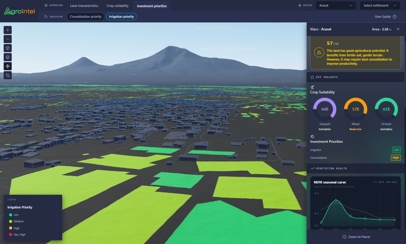
AgroIntel as an Agricultural Intelligence Platform
AgroIntel is an interactive geospatial application designed to support agricultural analysis, planning, and high-level decision-making. It brings together AI-derived agricultural land information, satellite imagery, public environmental datasets, and GIS-based analysis into one platform for Armenia.
Rather than presenting datasets separately, AgroIntel organizes agricultural intelligence around three practical themes:
Land Characteristics
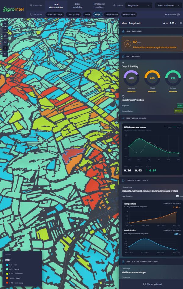
Vegetation health, slope, temperature, precipitation, parcel size and shape, and overall land quality.
Crop Suitability
Suitability indicators for selected crops such as vineyards, wheat, and orchards, based on environmental and land conditions.
Investment Priorities
Indicators that highlight where irrigation or land consolidation may provide meaningful agricultural benefit.
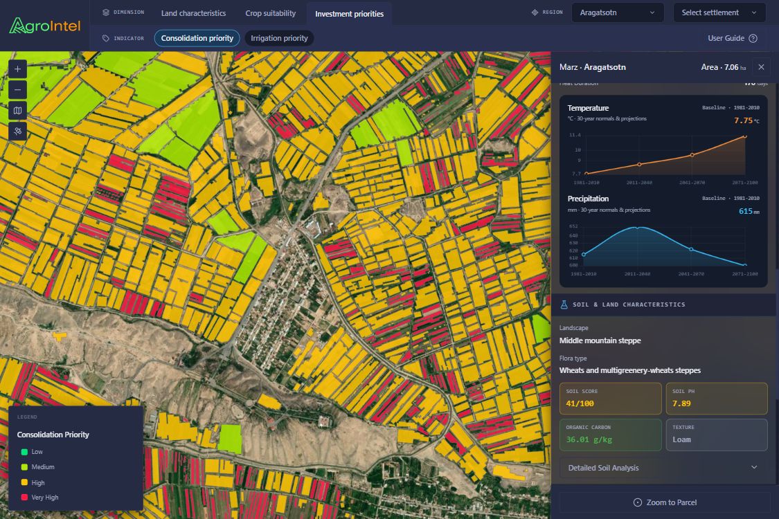
From Mapping to Intelligence
AgroIntel helps users move from the simple question “Where is agricultural land?” to more meaningful, decision-oriented questions:
From Data Layers to Decision Support
AgroIntel integrates multiple public datasets and geospatial inputs, including AI-derived agricultural field data, soil information, terrain data, climate data, and crop-related information. These datasets are processed and combined to create normalized indicators that allow comparison between different parcels and regions.
The application’s land quality score summarizes multiple factors into a single understandable indicator. It combines elements such as vegetation performance, soil quality, climate conditions, terrain, and land structure. The result is not a replacement for field surveys or agronomic expertise, but a useful starting point for understanding agricultural potential at scale.
Similarly, investment priority indicators help translate complex environmental and spatial conditions into planning insights. An area with good agricultural potential but limited water availability may become a priority for irrigation assessment. A productive but fragmented agricultural area may become a candidate for consolidation programs.
Who Can Benefit?
Farmers & Landowners
Better understand land strengths, limitations, vegetation performance, and crop suitability.
Government Agencies
Support agricultural policy, irrigation planning, land consolidation, and food-security initiatives.
Researchers & Investors
Explore spatial patterns, evaluate land potential, and identify areas where interventions may generate value.
Supporting Sustainability, Food Security, and Policy
Agricultural planning is no longer only about production. It is also about sustainability, climate resilience, efficient land use, and food security. AgroIntel supports these objectives by making land conditions visible and comparable.
Vegetation health indicators help monitor productivity patterns. Terrain indicators help identify physical constraints and possible erosion risks. Climate and precipitation indicators support crop suitability analysis. Soil indicators help users understand fertility and land quality. Parcel size and shape indicators highlight the challenge of fragmentation and the potential benefits of consolidation.
Public Data Sources
AgroIntel builds on publicly available and scientific datasets, including agricultural field data, soil, terrain, climate, and crop-related information.
Responsible Use and Limitations
AgroIntel is designed as a decision-support and exploratory analysis platform. Its outputs are based on public datasets, satellite observations, and automated modeling. The application does not replace local field knowledge, official cadastral validation, soil sampling, or detailed agronomic studies.
The indicators, including crop suitability and investment priorities, should be considered indicative. Users are encouraged to validate findings with local expertise, field observations, and additional authoritative data sources before making operational, financial, or policy decisions.
Turning Agricultural Data into Action
AgroIntel demonstrates how AI and GIS can work together to support smarter agricultural planning, sustainable land management, investment prioritization, and food-security decision-making.
Open AgroIntel