Aug 3, 2023
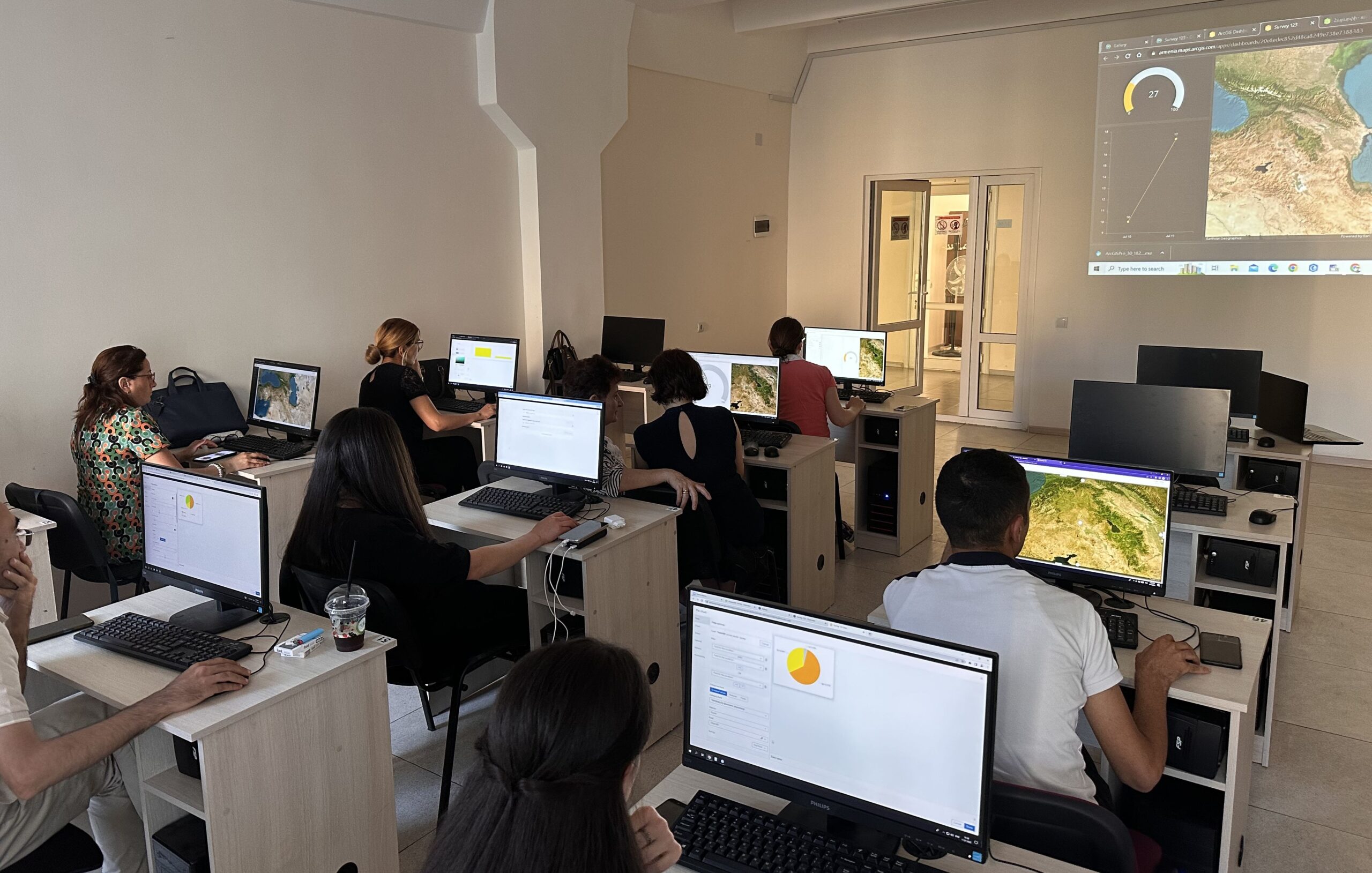
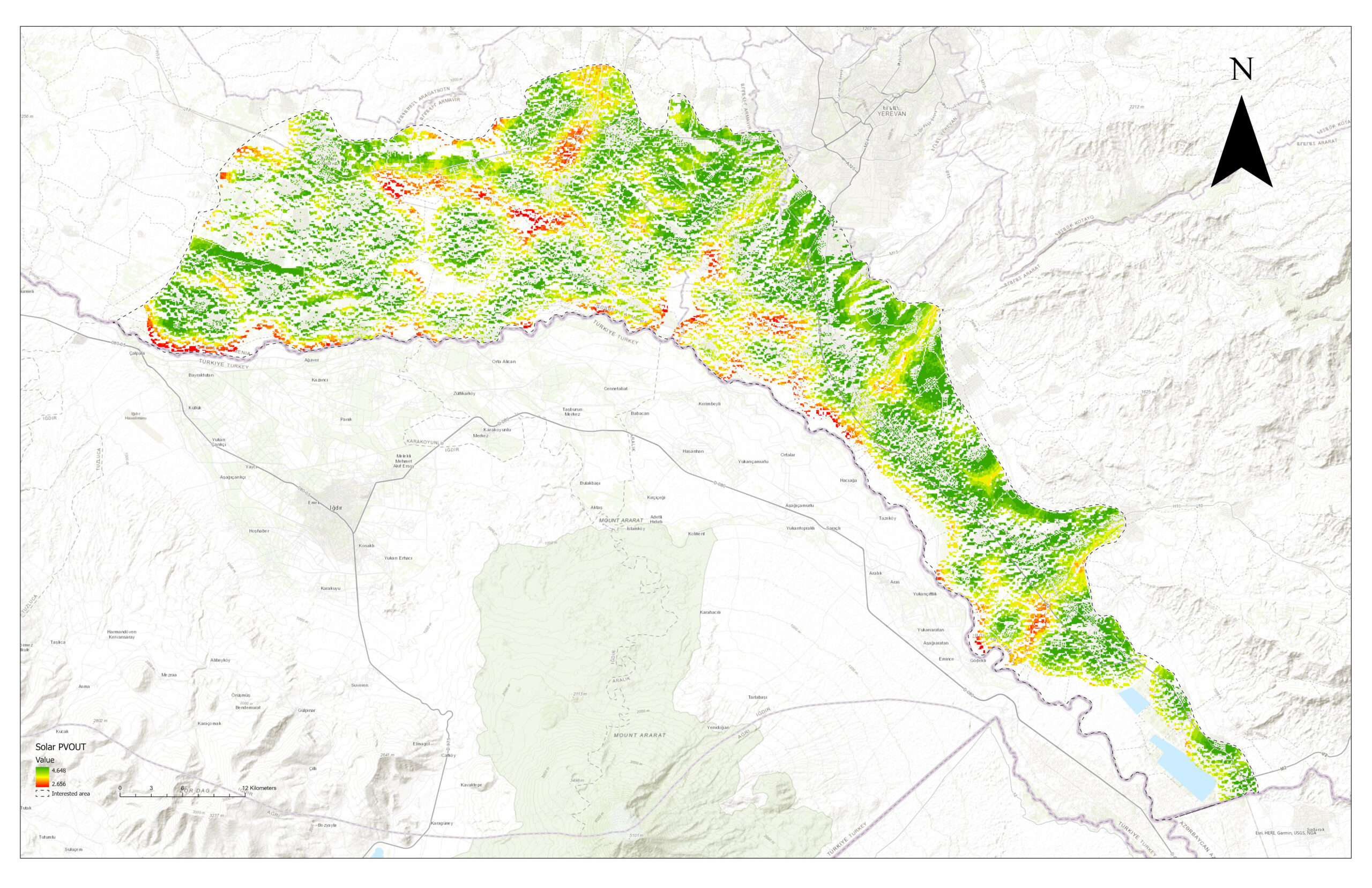
In the context of modern agriculture, innovative solutions are needed to tackle challenges such as increasing global population, climate change uncertainties, soil degradation, and water scarcity. In Armenia, leveraging Geographic Information Systems (GIS) and Remote...
Jun 19, 2023
В ответ на растущую потребность в образовании, основанном на подходе STEM, Geovibe представило геопространственную программу “GIS4Schools”, предназначенную как для учащихся, так и для преподавателей, для использования ГИС в качестве инструмента обучения в классе. При...
May 8, 2023
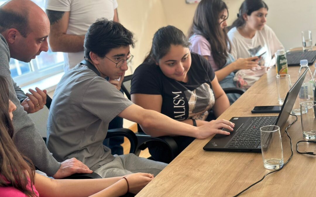
In response to the growing need for STEM-driven education, Geovibe CJSC (Geovibe) introduced GIS4Schools – a geospatial program designed for both students and teachers to leverage GIS as a learning tool in the classroom. By integrating this program into a...
May 2, 2023
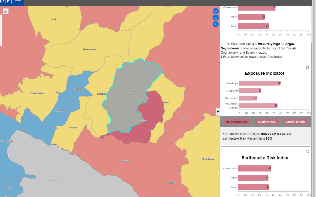
Программа Развития Организации Объединенных Наций (ПРООН) инициировала уникальный пилотный проект – «Индекс Опасности Стихийных Бедствий» (Индекс Риска) в трех областях Республики Армения (Тавушской, Гегаркуникской и Сюникской). Целью проекта является поддержка и...
Apr 28, 2023
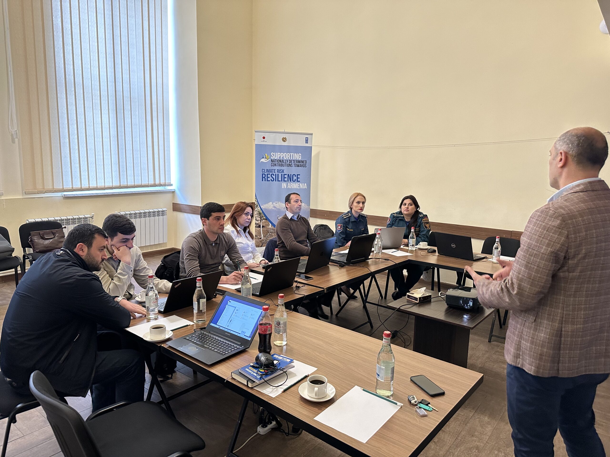
The United Nations Development Program (UNDP) initiated a unique pilot project, the Natural Risk Hazard Index, for the three regions (Tavush, Gegharkunik and Syunik) in the Republic of Armenia with the aim of supporting and optimizing the work and improving...

Feb 3, 2023
It’s the internship hunt season! Have you thought of doing your internship with us here in Armenia while getting exposed to your homeland’s local culture, work environment, and daily life? Yes, it is possible! Thanks to our growing network of 1,300+...